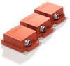
Exail Airborne Survey Inertial Navigation System AIRINS

Description
AIRINS, engineered for optimal integration and ease-of use, utilizes iXBlue's expertise in fiber-optic gyroscopes (FOG), already in use in satellite control. AIRINS combines the latest motion sensing technology, electronics and embedded processing design in one single unit. This offers the most compact position, orientation and direct georeferencing system.
Description
AIRINS, engineered for optimal integration and ease-of use, utilizes iXBlue's expertise in fiber-optic gyroscopes (FOG), already in use in satellite control. AIRINS combines the latest motion sensing technology, electronics and embedded processing design in one single unit. This offers the most compact position, orientation and direct georeferencing system.

Suppliers

Company
Product
Description
Supplier Links
Airborne Survey Inertial Navigation System - AIRINS - Exail
Saint-Germain en Laye, France
Airborne Survey Inertial Navigation System
AIRINS
Airborne Survey Inertial Navigation System AIRINS
AIRINS, engineered for optimal integration and ease-of use, utilizes iXBlue's expertise in fiber-optic gyroscopes (FOG), already in use in satellite control. AIRINS combines the latest motion sensing technology, electronics and embedded processing design in one single unit. This offers the most compact position, orientation and direct georeferencing system.

AIRINS, engineered for optimal integration and ease-of use, utilizes iXBlue's expertise in fiber-optic gyroscopes (FOG), already in use in satellite control. AIRINS combines the latest motion sensing technology, electronics and embedded processing design in one single unit. This offers the most compact position, orientation and direct georeferencing system.

Supplier's Site

Technical Specifications

  Exail
Product Category Navigational Instruments
Product Number AIRINS
Product Name Airborne Survey Inertial Navigation System
Unlock Full Specs
to access all available technical data