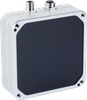
Datalogic USA, Inc. Navigation scanner Datalogic 958200001 - LGS-N50 958200001

Description
The Navigation Scanner LGS-N50 by Datalogic is used for distance and angle measurement for the automatic vehicle guidance of suitable vehicles, such as forklift trucks. To this end, the scanner can be mounted onto the vehicle. Here the measurement data is sent to ther FTS control system. The navigation scanner has a comprehensive scanning angle of 360° and a scanning range of 0.2 to 50 m. The integrated webserver and the measurement data protocol enable simple and fast installation and commissioning. The Navigation Scanner LGS-N50 is connected via a 4-pole M12 connector and has an Ethernet interface.

Suppliers

Company
Product
Description
Supplier Links
Navigation scanner Datalogic 958200001 - LGS-N50 -  - Automation24, Inc.
King of Prussia, PA, United States
Navigation scanner Datalogic 958200001 - LGS-N50
The Navigation Scanner LGS-N50 by Datalogic is used for distance and angle measurement for the automatic vehicle guidance of suitable vehicles, such as forklift trucks. To this end, the scanner can be mounted onto the vehicle. Here the measurement data is sent to ther FTS control system. The navigation scanner has a comprehensive scanning angle of 360° and a scanning range of 0.2 to 50 m. The integrated webserver and the measurement data protocol enable simple and fast installation and commissioning. The Navigation Scanner LGS-N50 is connected via a 4-pole M12 connector and has an Ethernet interface.

The Navigation Scanner LGS-N50 by Datalogic is used for distance and angle measurement for the automatic vehicle guidance of suitable vehicles, such as forklift trucks. To this end, the scanner can be mounted onto the vehicle. Here the measurement data is sent to ther FTS control system. The navigation scanner has a comprehensive scanning angle of 360° and a scanning range of 0.2 to 50 m. The integrated webserver and the measurement data protocol enable simple and fast installation and commissioning. The Navigation Scanner LGS-N50 is connected via a 4-pole M12 connector and has an Ethernet interface.

Supplier's Site

Technical Specifications

  Automation24, Inc.
Product Category Vision Sensors
Product Name Navigation scanner Datalogic 958200001 - LGS-N50
Unlock Full Specs
to access all available technical data

Similar Products

Localization systems: Triton Floor-LOC - TLOC100-100 - SICK
Specs
Inspection Functions Object Position
Format / Output Absolute position (x, y, direction angle) Relative position (visual odometry)
Width / Diameter 4.33 inch (110 mm)
View Details
Blackfly S Board Level Designed for Embedded Vision Systems - BFS-U3-16S2C-BD2 - Teledyne FLIR IIS
Specs
Monochrome / Color Color
Imaging Technology CMOS Camera
Format / Output USB; USB 3 Port
View Details
Compact vision system - SBOI-Q-R3C-WB-S1 - Festo Corporation
Specs
Horizontal Resolution 752 to ? lines
Operating Temperature 14 to 122 F (-10 to 50 C)
View Details