M.A.E. Apparecchiature Elettroniche srl Software, 2D Processing for Electrical Tomography Res2D

Description
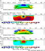
Two-dimensional (2D) electrical imaging surveys are now widely used to map areas of moderately complex geology where conventional 1D resistivity sounding and profiling techniques are inadequate. Results from such surveys are usually plotted in the form of a pseudo section which gives an approximate but distorted picture of the subsurface geology. RES2DINVx32/x64 programs use the smoothness-constrain ed Gauss-Newton least-squares method inversion technique to produce a 2D model of the subsurface from the apparent resistivity data alone. It is completely automatic and the user does not even have to supply a starting model. This program has been optimized for the inversion of large data sets. The use of available memory is optimized so as to reduce the computer time by minimizing disk swapping. On a modern microcomputer, the inversion of a single pseudo section is usually completed within seconds to minutes. Four different techniques for topographic modelling are available in this program. Together with the free 2D forward modeling program RES2DMOD, it forms a complete 2D resistivity forward modeling and inversion package.
Datasheet
Description
Two-dimensional (2D) electrical imaging surveys are now widely used to map areas of moderately complex geology where conventional 1D resistivity sounding and profiling techniques are inadequate. Results from such surveys are usually plotted in the form of a pseudo section which gives an approximate but distorted picture of the subsurface geology. RES2DINVx32/x64 programs use the smoothness-constrain ed Gauss-Newton least-squares method inversion technique to produce a 2D model of the subsurface from the apparent resistivity data alone. It is completely automatic and the user does not even have to supply a starting model. This program has been optimized for the inversion of large data sets. The use of available memory is optimized so as to reduce the computer time by minimizing disk swapping. On a modern microcomputer, the inversion of a single pseudo section is usually completed within seconds to minutes. Four different techniques for topographic modelling are available in this program. Together with the free 2D forward modeling program RES2DMOD, it forms a complete 2D resistivity forward modeling and inversion package.
Datasheet

Suppliers

Company
Product
Description
Supplier Links
Software, 2D Processing for Electrical Tomography - Res2D - M.A.E. Apparecchiature Elettroniche srl
Frosolone, Isernia, Italy
Software, 2D Processing for Electrical Tomography
Res2D
Software, 2D Processing for Electrical Tomography Res2D
Two-dimensional (2D) electrical imaging surveys are now widely used to map areas of moderately complex geology where conventional 1D resistivity sounding and profiling techniques are inadequate. Results from such surveys are usually plotted in the form of a pseudo section which gives an approximate but distorted picture of the subsurface geology. RES2DINVx32/x64 programs use the smoothness-constrain ed Gauss-Newton least-squares method inversion technique to produce a 2D model of the subsurface from the apparent resistivity data alone. It is completely automatic and the user does not even have to supply a starting model. This program has been optimized for the inversion of large data sets. The use of available memory is optimized so as to reduce the computer time by minimizing disk swapping. On a modern microcomputer, the inversion of a single pseudo section is usually completed within seconds to minutes. Four different techniques for topographic modelling are available in this program. Together with the free 2D forward modeling program RES2DMOD, it forms a complete 2D resistivity forward modeling and inversion package.

Two-dimensional (2D) electrical imaging surveys are now widely used to map areas of moderately complex geology where conventional 1D resistivity sounding and profiling techniques are inadequate. Results from such surveys are usually plotted in the form of a pseudo section which gives an approximate but distorted picture of the subsurface geology.

RES2DINVx32/x64 programs use the smoothness-constrained Gauss-Newton least-squares method inversion technique to produce a 2D model of the subsurface from the apparent resistivity data alone. It is completely automatic and the user does not even have to supply a starting model. This program has been optimized for the inversion of large data sets. The use of available memory is optimized so as to reduce the computer time by minimizing disk swapping. On a modern microcomputer, the inversion of a single pseudo section is usually completed within seconds to minutes. Four different techniques for topographic modelling are available in this program. Together with the free 2D forward modeling program RES2DMOD, it forms a complete 2D resistivity forward modeling and inversion package.

Supplier's Site Datasheet

Technical Specifications

  M.A.E. Apparecchiature Elettroniche srl
Product Category Geographic Information Systems Software (GIS)
Product Number Res2D
Product Name Software, 2D Processing for Electrical Tomography
Unlock Full Specs
to access all available technical data