Airbus Group Earth Observation Satellite TanDEM-X

Description
Formation flying for a picture of precision TanDEM-X (‘TerraSAR-X add-on for Digital Elevation Measurement’) is an Earth observation satellite, which, together with the almost identical TerraSAR-X radar satellite, forms a high-precision radar interferometer system. The TerraSAR-X/TanDEM-X satellite formation can generate images similar to stereoscopic pictures. It is measuring all the Earth’s land surface (150 million square kilometres) within a period of less than three years. For a 12m grid (street width), surface height information can then be determined with an accuracy of under two meters. One goal is the production of a global Digital Elevation Model of unprecedented accuracy. As for TerraSAR-X, the TanDEM-X project is a Public–Private Partnership between Airbus Defence and Space GmbH and the German space agency DLR. TanDEM-X was launched on 21 June 2010 from the Baikonur Cosmodrome (Kazakhstan) on board a Dnepr launcher and is designed for five years of operation. Use of the data for scientific applications will be the responsibility of the DLR, commercial marketing of the data is managed by Airbus Defence and Space’ GEO-Information Division. Fact Sheet Customer DLR (Deutsches Zentrum für Luft- und Raumfahrt) Mission To generate a global Digital Elevation Model (DEM) with unprecedented accuracy Orbit Sun-synchronous dusk-dawn orbit Spacecraft Rebuild of the TerraSAR-X satellite which was based on the Airbus Defence and Space Flexbus concept and extensive heritage from the CHAMP and GRACE missions Payload • Active phased array X-band Synthetic Aperture Radar (SAR) • Tracking, Occultation and Ranging (TOR) equipment Features • X-band downlink horn antenna is mounted at the tip of a 3.3m long boom • Solid state mass memory capacity is 768Gbit • High-pressure nitrogen gas propulsion system for formation flying Launch Mass 1340kg (spacecraft: 1220kg, fuel: 120kg) Dimensions 5m length, 2.4m diameter (hexagonal cross section) Launch Date June 2010 on DNEPR-1 rocket from Baikonur Mission Duration 5 years Airbus Defence and Space Responsibilities Prime contractor, SAR and satellite integration and testing, manufacturer of many electronic units including On-Board Computer and Solid State Mass Memory
Description
Formation flying for a picture of precision TanDEM-X (‘TerraSAR-X add-on for Digital Elevation Measurement’) is an Earth observation satellite, which, together with the almost identical TerraSAR-X radar satellite, forms a high-precision radar interferometer system. The TerraSAR-X/TanDEM-X satellite formation can generate images similar to stereoscopic pictures. It is measuring all the Earth’s land surface (150 million square kilometres) within a period of less than three years. For a 12m grid (street width), surface height information can then be determined with an accuracy of under two meters. One goal is the production of a global Digital Elevation Model of unprecedented accuracy. As for TerraSAR-X, the TanDEM-X project is a Public–Private Partnership between Airbus Defence and Space GmbH and the German space agency DLR. TanDEM-X was launched on 21 June 2010 from the Baikonur Cosmodrome (Kazakhstan) on board a Dnepr launcher and is designed for five years of operation. Use of the data for scientific applications will be the responsibility of the DLR, commercial marketing of the data is managed by Airbus Defence and Space’ GEO-Information Division. Fact Sheet Customer DLR (Deutsches Zentrum für Luft- und Raumfahrt) Mission To generate a global Digital Elevation Model (DEM) with unprecedented accuracy Orbit Sun-synchronous dusk-dawn orbit Spacecraft Rebuild of the TerraSAR-X satellite which was based on the Airbus Defence and Space Flexbus concept and extensive heritage from the CHAMP and GRACE missions Payload • Active phased array X-band Synthetic Aperture Radar (SAR) • Tracking, Occultation and Ranging (TOR) equipment Features • X-band downlink horn antenna is mounted at the tip of a 3.3m long boom • Solid state mass memory capacity is 768Gbit • High-pressure nitrogen gas propulsion system for formation flying Launch Mass 1340kg (spacecraft: 1220kg, fuel: 120kg) Dimensions 5m length, 2.4m diameter (hexagonal cross section) Launch Date June 2010 on DNEPR-1 rocket from Baikonur Mission Duration 5 years Airbus Defence and Space Responsibilities Prime contractor, SAR and satellite integration and testing, manufacturer of many electronic units including On-Board Computer and Solid State Mass Memory

Suppliers

Company
Product
Description
Supplier Links
Earth Observation Satellite - TanDEM-X - Airbus Group
Leiden, CS, Netherlands
Earth Observation Satellite
TanDEM-X
Earth Observation Satellite TanDEM-X
Formation flying for a picture of precision TanDEM-X (‘TerraSAR-X add-on for Digital Elevation Measurement’) is an Earth observation satellite, which, together with the almost identical TerraSAR-X radar satellite, forms a high-precision radar interferometer system. The TerraSAR-X/TanDEM-X satellite formation can generate images similar to stereoscopic pictures. It is measuring all the Earth’s land surface (150 million square kilometres) within a period of less than three years. For a 12m grid (street width), surface height information can then be determined with an accuracy of under two meters. One goal is the production of a global Digital Elevation Model of unprecedented accuracy. As for TerraSAR-X, the TanDEM-X project is a Public–Private Partnership between Airbus Defence and Space GmbH and the German space agency DLR. TanDEM-X was launched on 21 June 2010 from the Baikonur Cosmodrome (Kazakhstan) on board a Dnepr launcher and is designed for five years of operation. Use of the data for scientific applications will be the responsibility of the DLR, commercial marketing of the data is managed by Airbus Defence and Space’ GEO-Information Division. Fact Sheet Customer DLR (Deutsches Zentrum für Luft- und Raumfahrt) Mission To generate a global Digital Elevation Model (DEM) with unprecedented accuracy Orbit Sun-synchronous dusk-dawn orbit Spacecraft Rebuild of the TerraSAR-X satellite which was based on the Airbus Defence and Space Flexbus concept and extensive heritage from the CHAMP and GRACE missions Payload • Active phased array X-band Synthetic Aperture Radar (SAR) • Tracking, Occultation and Ranging (TOR) equipment Features • X-band downlink horn antenna is mounted at the tip of a 3.3m long boom • Solid state mass memory capacity is 768Gbit • High-pressure nitrogen gas propulsion system for formation flying Launch Mass 1340kg (spacecraft: 1220kg, fuel: 120kg) Dimensions 5m length, 2.4m diameter (hexagonal cross section) Launch Date June 2010 on DNEPR-1 rocket from Baikonur Mission Duration 5 years Airbus Defence and Space Responsibilities Prime contractor, SAR and satellite integration and testing, manufacturer of many electronic units including On-Board Computer and Solid State Mass Memory

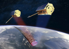
Formation flying for a picture of precision

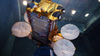
TanDEM-X (‘TerraSAR-X add-on for Digital Elevation Measurement’) is an Earth observation satellite, which, together with the almost identical TerraSAR-X radar satellite, forms a high-precision radar interferometer system.

The TerraSAR-X/TanDEM-X satellite formation can generate images similar to stereoscopic pictures. It is measuring all the Earth’s land surface (150 million square kilometres) within a period of less than three years. For a 12m grid (street width), surface height information can then be determined with an accuracy of under two meters. One goal is the production of a global Digital Elevation Model of unprecedented accuracy.

As for TerraSAR-X, the TanDEM-X project is a Public–Private Partnership between Airbus Defence and Space GmbH and the German space agency DLR. TanDEM-X was launched on 21 June 2010 from the Baikonur Cosmodrome (Kazakhstan) on board a Dnepr launcher and is designed for five years of operation.

Use of the data for scientific applications will be the responsibility of the DLR, commercial marketing of the data is managed by Airbus Defence and Space’ GEO-Information Division.

Fact Sheet

CustomerDLR (Deutsches Zentrum für Luft- und Raumfahrt)
MissionTo generate a global Digital Elevation Model (DEM) with unprecedented accuracy
OrbitSun-synchronous dusk-dawn orbit
SpacecraftRebuild of the TerraSAR-X satellite which was based on the Airbus Defence and Space Flexbus concept and extensive heritage from the CHAMP and GRACE missions
Payload• Active phased array X-band Synthetic Aperture Radar (SAR)

• Tracking, Occultation and Ranging (TOR) equipment

Features• X-band downlink horn antenna is mounted at the tip of a 3.3m long boom
• Solid state mass memory capacity is 768Gbit
• High-pressure nitrogen gas propulsion system for formation flying
Launch Mass1340kg (spacecraft: 1220kg, fuel: 120kg)
Dimensions5m length, 2.4m diameter (hexagonal cross section)
Launch DateJune 2010 on DNEPR-1 rocket from Baikonur
Mission Duration5 years
Airbus Defence and Space ResponsibilitiesPrime contractor, SAR and satellite integration and testing, manufacturer of many electronic units including On-Board Computer and Solid State Mass Memory
Supplier's Site

Technical Specifications

  Airbus Group
Product Category Satellites
Product Number TanDEM-X
Product Name Earth Observation Satellite
Unlock Full Specs
to access all available technical data

Similar Products